
With a survey group of more than 30, including licensed professional Drone surveyors and DGPS operators; Prinav GIS brings solutions to achieve a project's specific schedule, cost, and/or complexity challenges.
We have a long-standing history of surveying and engineering experience that includes topographic surveys, sub-surface utility surveys, Drone surveys, boundary surveys, Right-of-Way, and land acquisition services. Our project approach is to provide local and consistent staffing to ensure responsive and reliable service to our clients – providing staffing solutions that match any project need. Prinav GIS's survey experience involves both the private and public sector including municipalities, education, state departments of transportation, and federal agencies.
Final Location / RECT / PECT / Doubling for Rail Lines
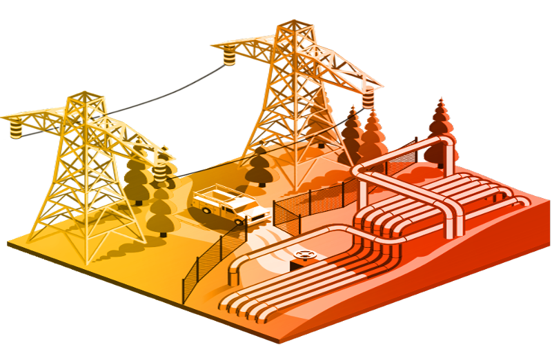
Electrical Utility Surveys
Transmission Line Surveys
Gas Pipe Surveys
Drone Surveys
Water / Sewerage Pipeline Surveys
Property and Consumer Surveys
We utilize high-end technology for survey execution, including:
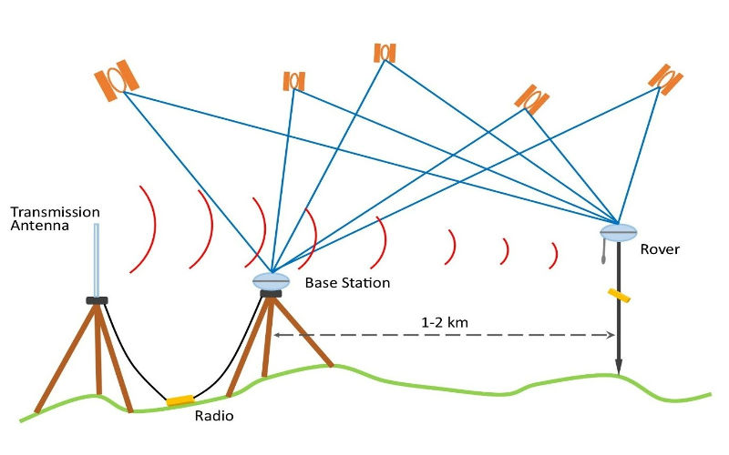
We provide DGPS & GPS Survey for various utilities, roads, land, rail, and forests.

The company has its own fleet of drones for various surveying needs. We are empanelled with government agencies for drone services and have DCGA-approved pilots.
Measured electrical refers to the act of taking measurements or readings of electrical parameters in a system or circuit. These are crucial for performance analysis in electrical systems.

We provide services to locate the alignment for transmission lines, pipelines, and cable networking, along with contouring and topographical profiling for design purposes.
Topographical surveys help to identify elevation differences and existing terrain conditions, assisting the design team in designing the proposed ground profile.
We establish a network of control points, ensuring precision for accurate measurements during the project. Control points directly affect the accuracy of the final survey.
Route surveys help to locate the alignment for transmission lines, pipelines, and cable networking. We provide sectional profiles with topographical data for practical design feasibility.

Setting-out work refers to marking or staking out precise locations for elements on a construction site to establish positions for structures and boundaries.

We calculate cutting and filling volumes while analyzing ground profiles for proposed construction or development projects, including roads, buildings, and industrial complexes.
Survey Professionals
Projects Completed
Approved Pilots
Survey Services
Let our expert survey team help you with precise measurements and comprehensive surveying solutions for your next project.